Jack and Jude share their favourite cruising spots around Tasmania. Reproduced from the Spring 2021 edition of Offshore.
After miles of adrenalin-pumping drama fighting for the advantage, racing across a blue ocean, celebrate a job well done. Take time to relax.
After all, Tasmania is the right place for that—a sailor’s paradise known the world round for World Heritage splendour, healthy food, uncluttered space and friendly, easy going folk.
Jack and Jude discovered this corner of heaven in 2009, after a peaceful passage across the Great Australian Bight from Albany. When entering Macquarie Harbour through Hells Gate, instead of the horror felt by convicted felons heading for Sarah Island, we kept pinching ourselves as towering mountains shimmered in reflections on the calm waterway six times larger than Sydney Harbour.
And with no development in sight, it’s been our home-base ever since.
We still sail round and round Australia, but we always return to the Apple Isle to recharge and repair. We love the place so much, we’re now residents. And to help others enjoy it too, we produce a travel cruising guide and several feature films showing Tassie’s rarely visited exquisite locations.
So let’s see if we can entice you to linger a little longer in Tasmania. Some of you may want to head home by the shortest route; others will have time to explore the wild, less visited places; so we’ll tell you about our favourite spots heading north back to Sydney, and south from Hobart.
Guide: Complete anchorage details and additional information will be found in our online cruising guide. Copy all you need. But, because the internet is not widely available beyond built-up areas, we recommend our premium version that displays perfectly on most device (download here).
Park Pass: Many of Tasmania’s iconic locations are in National Parks, requiring a Park Pass to enter. Day passes are available, but best buy the annual pass that can be assigned to your vessel.
Weather: In Tasmania, the weather is always a factor. The more pleasant weather is in January, February, and March, with average daytime temperatures between 20° C and 25° C. From our experience, the east and south coast can expect easterly winds around five to 12 days in January, the same for February.
GOING NORTH
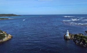
Port Arthur is a scenic 40 mile sail to a rather spooky anchorage right off the World Heritage prison built in 1830. There’s a quieter spot around the point in Stewards Bay. And from Safety Cove, near the entrance, you can walk to the Remarkable Cave in about 30 minutes. Nubeena is also an attractive first-day stop.
Along the way to Fortescue Bay, in good conditions you can pass between Tasman Island and Cape Pillar. But watch out for opposing swells meeting midway, and have your camera fully charged to capture the amazing dolerite columns, caves, and historic landing.
Fortescue Bay, 20 miles from Port Arthur, is a large forested bay with a narrow east-facing opening that occasionally experiences a long easy swell. Most vessels anchor in the least swell affected eastern corner of the beach. But we prefer a spot away from the campground against the gorgeous rock cliffs on the west side. If that’s a bit rolly, we look for a spot behind the wreck of the William Pitt in Canoe Bay, where there’s enough room for two vessels, maybe three if one is shallow draught.
The major attraction at Fortescue is the walk to Cape Hauy, famous for its soaring sea cliffs and impressive rock formations. I lost count, but there must be 500 steps on the 5 kilometre track starting from the campground. We take a lunch and make a day of it. Last time, we watched abseilers rappel. Another spectacular track that’s easier than Cape Hauy runs behind Canoe Bay, going north along the dolerite cliffs.
We next make the 30 mile run to the abruptly rising Maria Island, with free moorings off the historical remains at Darlington. Maria Island is a National Park with sweeping bays, dramatic cliffs, and the most intact example of a convict station in Australia. The stone Commissariat Store, 150 metres from the Darlington jetty, is the island’s oldest building and hosts a visitor centre with information displays.
Short walks explore the buildings and ruins of Darlington. The Painted Cliffs and Fossil Cliffs are other popular destinations for day visitors, where walkers might encounter wombats, as well as pademelons, Forester Kangaroos, Bennetts wallabies and Tasmanian Devils.
Chinamans Bay, seven miles before Darlington, is less busy, with good flathead fishing and less impressive ruins a thirty-minute walk away. (Check out this video for a glimpse)
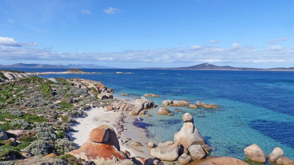
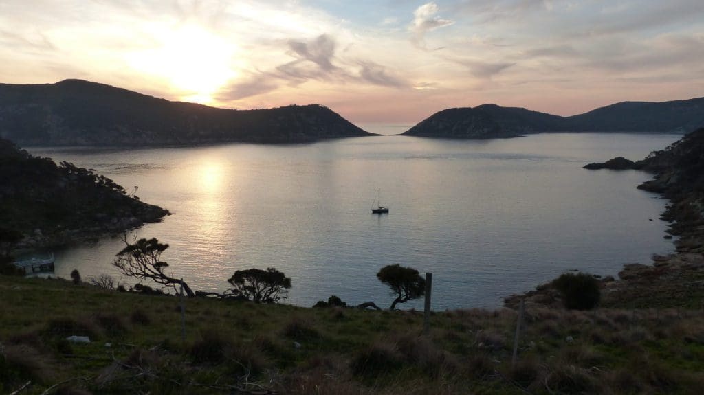
Schouten Island, dangling from the Freycinet Peninsula, has a delightful walk up Bear Mountain for views over Schouten Passage to Wineglass Bay (Watch this video).
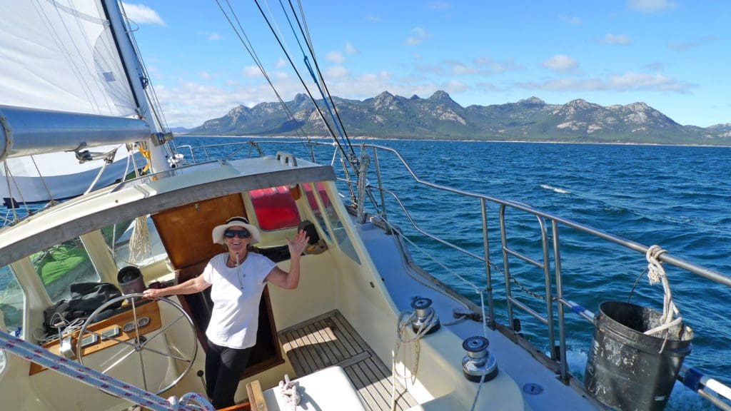
Wineglass Bay is famous for its red and pink granite formations that make it Instagram Heaven. The jewel of Tasmania’s eastern coastline, picture-perfect Wineglass is far more than just a place to anchor off a crescent of sand curling round glittering blue-green ocean framed by forested mountains. The Lookout Walk to the top of The Hazards is the photo everyone wants. Or explore the other walks, too many to describe here. One drawback; the anchorage is exposed to easterly weather.
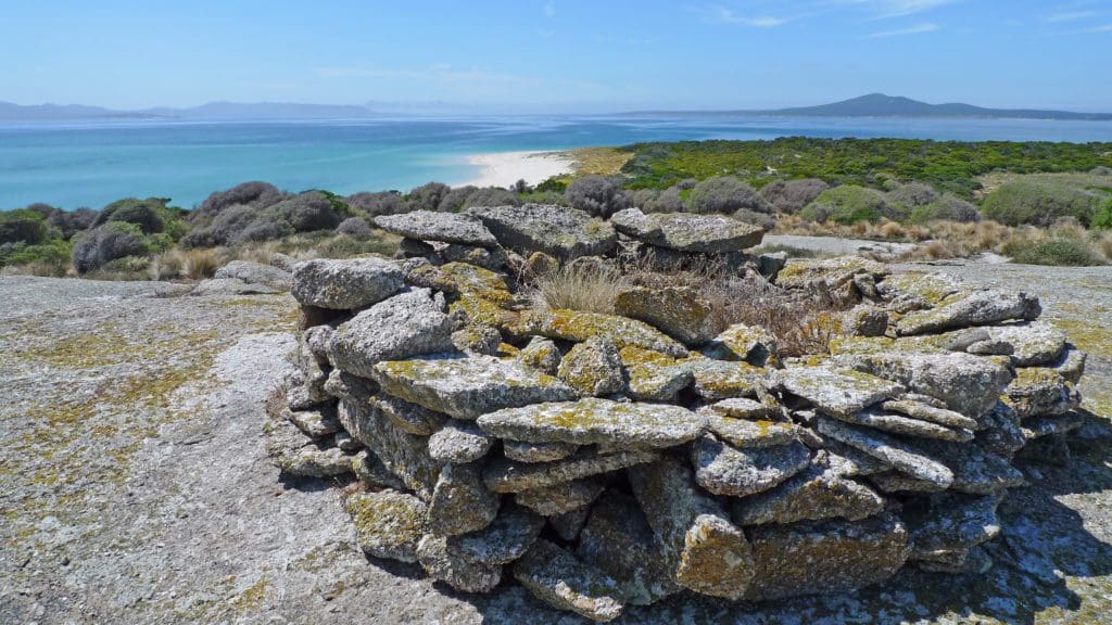
The final destination before departing Tasmania, the Furneaux Group, contains over 50 islands enjoying a Mediterranean climate subjected to the Roaring Forties and Bass Strait volatility. Sculpted by the sea, they are nature’s beauty and the beast. Dense bushland, crisp white sand, and turquoise waters teeming with wildlife, wrecks, and historical artefacts. Tempestuous winds and weedy anchorages beset them.
Straddling latitude 40°S, their isolation, turbulent history, and free-spirited independence add unique flavour to the group’s unspoiled natural beauty. The estimated population of 1004 live mainly on the three largest islands; Flinders, Cape Barren, and Clarke. Whitemark is the administrative centre. Lady Barron is its fishing centre and only port.
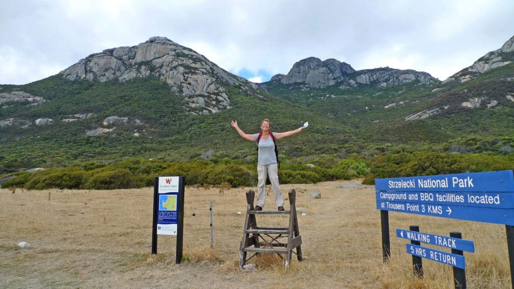
Our go-to island in the Furneaux Group is Preservation Island in the shadow Cape Barren Island at the western end of the Armstrong Channel. Why? A wreck began reshaping Australia there. It’s an intriguing story. Google “The Sydney Cove 1797”, or enjoy seeing the island and hearing the story in our film, Summer Sixteen. (Watch the video)
Next, climb the dramatic Strzelecki Mountains, seen from Preservation, for spectacular views over the islands. Start from Trousers Point, where there are two Mast moorings. Protection from NW thru N to SE. It’s a big hike, so start early.
North from there, find diamonds on the beach of Killiecrankie Bay, sheltered from E through S to W. On shore, there is a fishing village with restaurant. It’s a good place to depart for home.
GOING SOUTH
Straightaway there are two routes: A meander down the d’Entrecasteaux Channel or a sail outside Bruny Island to Recherche Bay or South East Cape. Then the south coast and Port Davey.
When going south around Tasmania, it’s wise to have plenty of fuel, water and food on board, because summer winds can be feast or famine. They’re available in Hobart, then easily obtained at the Kettering Marina and Van Diemen Seafood on the jetty at Dover, where there’s a supermarket. Next supplies not until Strahan.
“The Channel” is what the locals call the 30 mile protected slot inside Bruny Island containing heaps of anchorages in sandy bays surrounded by grassy slopes dotted with sparse stunted woodlands. The Huon River enters about halfway, giving access to the attractive villages of Cygnet and Huonville in forested valleys. Further along lie Port Esperance and Southport. If a kayak paddle on picturesque waterways is your thing, ring our mates at Esperance Adventures (more information here), for tours including all the gear. This around the world sailing family has massive local knowledge.
Frankly, if a northerly is blowing, we prefer the straight run outside Bruny Island to avoid the fish farms and busy boat traffic in the Channel. Another possibility is a side trip to Port Arthur, then on to Recherche Bay.
Recherche Bay is your last anchorage before rounding South East Cape into the never-never. There are several anchorages—refer to our guide.
The road ends there, and the famous South Coast Track begins. But an easy stroll along the quiet beach takes in the peace and feeling of this remote place rich in history. Continue walking to reach the big bronze whale sculpture commemorating the early colonial days of whaling. Or take the well-marked track at Cockle Creek, 8 kilometres to South Cape Bay for stunning cliff-top views of the Southern Ocean.
Tasmania’s entire South Coast, the 70 miles between Recherche Bay and Port Davey, is part of the Southwest National Park. The largest park in Tasmania, over 600,000 hectares of amazingly wild, inspiring country. Many vessels make the passage in one long day. But, weather permitting, several places are brilliant stops.
The Southwest National Park is extremely remote, which helps preserve this fragile area from over development. Please treat the area with the respect it so deserves.
In March 2021, we took a lovely northerly non-stop out of civilisation, rounding South East Cape as the glorious red sun dipped below the sheer walls of the southern shores. Spume and mist faded in one last rainbow as the lighthouse on the last corner of humanity came alight, marking our passage into the wild abyss.
We gave South East Cape a wide berth, avoiding the chance of snagging a cray pot, and to keep away from the backwash of Southern Ocean swells. A wide berth also helped hold the fading north breeze that took us halfway across Tasmania’s 40 mile south coast before leaving us floating through the heaven’s glittering stars with the single flash atop Maatsuyker Island seven miles ahead.
Louisa Bay lies below the formidable Ironbound Range where the famous South Coast Track takes walkers from Cockle Creek to Melaleuca. Within that bay lies a calm weather anchorage alongside an island of swirling colours connected to the coast by a low sandy isthmus. Dive for abalone and crays, investigate the caves, and hear penguins calling.
De Witt Island is another visual feast worthy of a quiet motor past superb scenery.
New Harbour is a good anchorage in most conditions. Although open to the south, Entrance Island protects. A formed track found near the west corner of the beach goes to Hidden Bay, Ketchem, and SW Cape. Long pants and stout shoes recommended.
Enjoy a lunch at Maatsuyker Island anchored in the cove under the old haulage line with seals bobbing about. Overnight anchorage between Flat Island and Maatsuyker in 12 metres outside the kelp.
Port Davey is exposed to the Great Southern Ocean to Antarctica and only the narrow Bathurst Channel leads to safety. But it’s hidden until abreast of Breaksea Island, by which time rock cliffs surround. Best advice: Plan your voyage to arrive in daylight. Entering during strong onshore weather can be hazardous.
In 1798, Matthew Flinders, with his friend George Bass, set sail aboard the tiny Norfolk to prove Tasmania was indeed an island. As their frail craft pushed further into the icy Southern Ocean, both lads looked ahead to what appeared to be gigantic seals’ teeth erupting from turbulent water. Beyond them, they perceived, “the appearance of a considerable opening. The mountains, the most stupendous works of nature ever beheld, are the most dismal and barren. The eye ranges over these peaks with astonishment and horror.” Wisely, with a gale rising at their backs, they chart what they see and round South West Cape.
There are far too many anchorages to describe here, so grab a copy of our Tasmania Guide for full details, and download the Port Davey Reserve map that shows no-go zones and anchoring areas.
The following is a short list of our favourite stops and things to do (Click here to view the Port Davey YouTube video playlist).
On a sunny calm day, dinghy or kayak five miles up the Davey River to the gorge. Anchor vessel in Bond Bay or Payne Bay (watch this video for tips).
Bramble Cove, just inside Breaksea Island, is not the best all-weather anchorage but has a track up Mount Stokes for magical panorama over Port Davey and Bathurst Channel. Alternative route from NE corner of Wombat Cove (Watch this video).
Dinghy up the Old River into towering mountains and mirror reflections.
From Spain Bay, walk to Stephens Beach on the west coast to behold the humongous midden created by the Needwonnee People, who occupied southwest Tasmania for 30,000 years or more. Please respect this area; they may have been the most southerly people on earth during the last Ice Age.
Dinghy to Melaleuca and experience local Aboriginal culture on the Needwonnee Walk, then visit the Deny King Heritage Museum (Watch this video).
Good storm anchorages at King Bay and Frogs Hollow with splendid views of Mt Rugby. Avoid Schooner Cove in strong winds.
Best books to read:
– King of the South West—The life of Deny King, by Christobel Mattingley.
– Wyn and Clyde, by Janet Fenton.
– The Shank Revisited, a sailor’s guide to Tasmania’s southwest, by Ian Johnstone.
Macquarie Harbour, 90 miles north of Port Davey, is the second-largest natural harbour in Australia after Port Phillip Bay. It’s six times the size of Sydney Harbour. However, the real glory is not its size, but its setting. The surrounding wilderness, mountains and the Gordon River are otherworldly.
A superb cruising area, the nearly 20 mile-long Macquarie Harbour offers many isolated anchorages within a landlocked body of water. Some are quiet hideaways surrounded by pure nature; others offer outings and historical remnants (A list of Macquarie Harbour videos is available here).
Hells Gate was given that name by convicts being interned on Sarah Island. The name stuck because Hells Gate lies exposed to Southern Ocean swell and can have an extraordinary outpouring of water that is not based solely on tide, but a combination of wind, atmospheric pressure, and how much water is released by the Gordon River Power Station. Do not attempt after dark.
Cape Sorell protects Hells Gate from west and southwest winds making Pilot Bay a good anchorage (Watch us sail through the Gate on YouTube)
Once inside, anchor directly off the picturesque village of Strahan or moor inside the jetty for a wonderful experience among seafaring folks steeped in history. There’s a pub opposite the wharf and directly up the hill is a well-stocked IGA and pharmacy. For entertainment, head to the Morrisons Mill at 2:45PM for a fascinating demonstration of their antique equipment in action.
Step back in history and take the West Coast Wilderness Railway deep into thick rainforest, crossing forty-two bridges to incredible wilderness vantage points. Or splash out for a fabulous meal at the Bushmans, Regatta Point, or View 42° on the hilltop overlooking the village and harbour. Then before heading down harbour, grab Trevor Norton’s splendid charts at The Crays. They show the harbour, river, and interests in great detail.
FAVOURITE STOPS AND THINGS TO DO
From Betsys Bay, walk to the wild west coast for an awesome day (check out this video). If fit, scramble up Table Head for outstanding harbour and mountains views (check out this video).
Then rise early for an evocative atmosphere amongst the prison remains on Sarah Island before tour boats arrive. Or wait to follow a group to hear the guide. In Kelly Basin, explore the abandoned port and town of Pillinger, and then walk through exquisite rainforest up the Bird River Track.
In the Gordon River, stay overnight alongside Heritage Landing after the last tour boat departs. Then at Sir John Falls, walk through ancient rainforest on the historic Goulds Track (Watch this video). And, if river flow is slow, dinghy upstream past Big Eddy to the Franklin River. Please, safety first in these very remote areas.
King Island, Australia’s seventh largest island, is best known for its superb dairy produce, seafood, and beef, which are among the world’s best. KI’s pace of life is far slower than about anywhere in Australia, and the locals, around 2,000, boast the only traffic delays are from wallabies, turkeys, and pheasants.
Warning: King Island’s changeable weather and treacherous currents have claimed hundreds of ships and far more than a thousand souls. Play it safe. Do not add your ship to this record.
Our port of choice is Grassy Harbour for its relatively easy entry and all round protection (Watch this video). Although it lacks transport and facilities outside of a welcoming weekend yacht club, hiring a car solves the problem. In one or two days, a crew can visit all KI’s outstanding sights.
Our special outing is a picnic at Seal Rocks with magical coastal views. Then a wander round the nearby Calcified Forest or Copperhead cliffs trail. After visiting the cheese factory for tasting, take time for a clubhouse lunch with ocean views or a round of golf at the award-winning Ocean Dunes, overlooking Australia’s tallest lighthouse at Cape Wickham.
Currie, the island’s principal town, is quaint and artistic, bustling with local colour. Catering for your needs are two supermarkets and grog shops, plus a bakery featuring crayfish and scallop pies. Also worth a visit is the maritime museum overlooking the port displaying memorabilia from wrecks and island life.
When you head east, The Kent Group in Bass Strait is a handy stop. Be mindful of the katabatic winds that sometimes blast out Murray Pass separating the main islands. East Cove, off Deal Island, seems unaffected. From there, a track leads to the caretaker’s cottage and museum with expansive views from its front lawn. On the way is Telstra bench, the best place to reach a mobile tower.
An excellent exercise before the coming days of sailing is the forty-minute walk through casuarina woodlands to the lighthouse. Or a morning’s walk to Garden Cove across open grasslands, where wildlife abounds. Anchor off Erith in favourable conditions to stroll along the sandy shore amongst Cape Barren Geese to the exposed wreck. Full anchoring details in our guide.
Enjoy, and Bon Voyage from Jack and Jude, SY Banyandah (home on the water).